




Luxury Address, Flooded Reality : Why Posh Areas in Surat Continue to Drown Every Monsoon
SURAT : Every monsoon, residents of Surat’s prestigious VIP Road and adjoining Althan locality witness the same disturbing spectacle. Roads disappear beneath several feet of water, luxury...

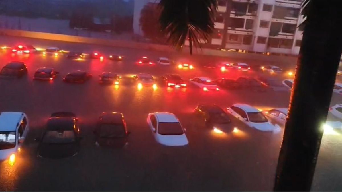
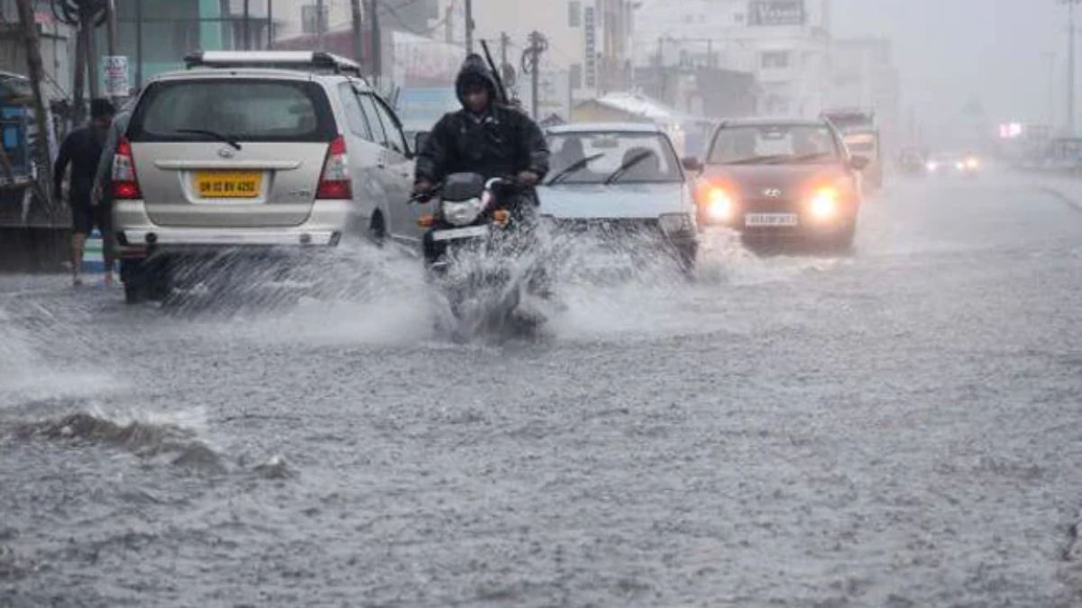
SURAT : Every monsoon, residents of Surat’s prestigious VIP Road and adjoining Althan locality witness the same disturbing spectacle. Roads disappear beneath several feet of water, luxury residential complexes remain marooned for hours, commercial establishments suffer extensive losses, and thousands of commuters struggle through submerged streets. Despite repeated flooding year after year, little appears to have changed in terms of scientific urban planning or long-term flood mitigation.
The irony is difficult to ignore. These localities represent some of the highest-valued real estate markets in South Gujarat. The names “VIP Road,” “New VIP Road,” and “Althan” have become synonymous with status and premium living. Owning a residence in these areas is often perceived as a symbol of social prestige. Developers have successfully marketed this image, and many homebuyers have invested their lifetime savings believing these neighbourhoods offer the highest standards of urban living.
However, every heavy rainfall exposes a starkly different reality.
The recent flooding once again demonstrated that branding cannot overcome geographical and hydrological realities. Several stretches of VIP Road remained inundated, residential societies experienced waterlogging, and commercial establishments suffered significant damage as floodwater entered shops and warehouses. For many business owners, the financial losses are no longer occasional incidents but recurring annual events. Expensive inventories, electronic equipment, furniture, garments and consumer goods continue to be damaged with every major rainfall, increasing insurance costs and reducing investor confidence in the locality.
The problem extends far beyond inconvenience. Repeated flooding raises fundamental questions about the manner in which these areas were planned and developed over the past two decades. Urban flooding is rarely caused by rainfall alone. Instead, it reflects the cumulative consequences of land-use decisions, drainage design, environmental degradation and inadequate urban governance.
Large parts of the VIP Road and Althan belt have witnessed rapid urbanisation on low-lying terrain historically influenced by natural drainage channels, wetlands and Khadis (tidal creeks). These natural systems once stored excess rainwater and allowed stormwater to drain gradually into the Tapi River. As urban expansion accelerated, many of these ecological buffers were either encroached upon, narrowed or replaced with buildings, roads and other impermeable surfaces. Rainwater that once infiltrated naturally into the ground now flows rapidly over concrete landscapes, overwhelming drainage networks that were never designed for such intense runoff.
Climate change has further aggravated the situation. Surat is experiencing increasingly intense short-duration rainfall events, while urban infrastructure continues to rely on drainage standards prepared decades ago under very different climatic conditions. Simultaneously, tidal influences along the Khadi network often reduce the efficiency of stormwater discharge during high tide, resulting in backwater effects that prolong flooding. These factors were foreseeable and should have formed the basis of modern urban planning.
Instead, development appears to have been driven largely by market demand rather than scientific evaluation of flood risks. The transformation of Althan into a premium residential destination encouraged developers to extend the “Althan” brand even into areas towards Pandesara and Vadod by introducing the concept of “New Althan,” similar to earlier branding strategies such as “New City Light.” While such marketing may enhance property values, it does not alter the underlying hydrology of the landscape. Geography cannot be rebranded.
One of the most concerning aspects of Surat’s recent urban expansion is the emergence of what may be described as vertical urban sprawl. Traditionally, urban sprawl referred to uncontrolled horizontal expansion. Today, however, the same phenomenon is occurring vertically, with clusters of high-rise buildings replacing open land without corresponding investments in drainage infrastructure, transportation networks, environmental buffers or public spaces. Modern architecture and luxury amenities often create the impression of planned urbanisation, yet many of these developments function little differently from densely congested settlements when viewed through the lens of infrastructure capacity and disaster resilience.
The recurring floods also expose a broader institutional challenge. Urban planning should never be limited to approving individual building proposals. Every new development modifies the hydrology of the surrounding watershed. Each basement, parking podium, paved surface and commercial complex contributes incrementally to increased runoff. Without cumulative hydrological assessment, isolated development approvals collectively produce citywide flooding.
It is therefore appropriate to ask whether comprehensive floodplain mapping, watershed modelling, cumulative environmental impact assessments and climate resilience studies formed an integral part of planning approvals for these rapidly expanding neighbourhoods. Equally important is whether drainage capacities were periodically reassessed to reflect increasing urban density and changing rainfall patterns. These are legitimate planning questions that deserve transparent technical evaluation rather than political debate.
Ironically, many of Surat’s older neighbourhoods have demonstrated greater resilience during monsoon events. Although the historic city faces its own infrastructure constraints, much of its urban fabric evolved gradually over centuries, adapting to local topography and natural drainage conditions. Several older areas occupy comparatively favourable ground levels and have developed drainage patterns that, despite their age, often perform better than newly urbanised flood-prone localities.
This observation challenges the widespread perception that newer automatically means better. In urban planning, sustainability is determined not by the age of a neighbourhood but by the scientific principles that guided its development.
For prospective homebuyers, these repeated flooding events should serve as an important reminder that property decisions must extend beyond architectural design and marketing brochures. Buyers routinely examine carpet area, amenities, connectivity and resale value, but very few inquire about flood history, natural drainage patterns, finished ground levels, flood return periods or climate resilience. Such parameters may ultimately prove far more valuable than premium branding.
The long-term solution lies not in repeatedly widening roads or installing larger pumps after every flood, but in fundamentally rethinking Surat’s development strategy. Urban expansion must be guided by integrated watershed planning, preservation of Khadis and wetlands, floodplain zoning, hydrodynamic modelling, nature-based stormwater management and rigorous environmental assessment before approving new developments. Scientific planning should become the foundation of urban growth rather than an afterthought once flooding occurs.
For residents considering future investments, this may also be the appropriate time to reassess perceptions about location. While every locality requires individual technical evaluation, repeated flooding suggests that environmentally sensitive Khadi-influenced zones demand greater caution than they have received in the past. In contrast, many established neighbourhoods within Surat’s historic core or carefully planned satellite townships located on more suitable terrain may offer greater long-term resilience, safety and sustainability.
The flooding witnessed on VIP Road is therefore not merely a seasonal inconvenience. It is a warning that urban branding cannot substitute for scientific planning. A prestigious address loses much of its value when residents must repeatedly protect their homes and businesses from floodwaters. As Surat continues its remarkable economic growth, the city’s greatest challenge will not be constructing more buildings but ensuring that future development respects the fundamental principles of hydrology, ecology and resilient urban planning.
Nature always remembers where water once flowed. Cities that ignore this simple truth eventually learn the lesson at enormous economic and social cost.
DISCLAIMER: This article is written by Dr. Pankaj Gandhi, Civil Engineer (AMIE), Urban Planner (CEPT University, Ahmedabad),Ph D in Urban Flooding in Surat, Dept of Civil Engg, SVNIT Surat,MBA (IIM Kozhikode), LL M (Human Rights Dept of Law, VNSGU Surat)—The views expressed are those of the author based on professional expertise in civil engineering, urban planning and urban flood management. They are intended to promote evidence-based discussion on sustainable urban development and climate-resilient city planning.